


Welcome to the Big Leagues
Written by Patrick Sherman Advanced Flight Technologies As seen in the November 2019 issue of Model Aviation.
THE FAA HAS ANNOUNCED a major change in how recreational drone pilots and aeromodelers can access the National Airspace System (NAS). The good news is that people flying for fun have access to more sky than ever, even under Advisory Circular 91-57, which held sway from 1981 to 2015. The bad news is that you will have to take a couple of extra steps to get it.
What Has Changed?
Recreational pilots can now access airspace that is controlled down to the surface, which surrounds any airport with an active control tower. This opens a huge number of new locations for aeromodeling, particularly in cities with major airports where flying was not previously permitted.
To accomplish this, you will use the same system as licensed commercial drone operators, the Low Altitude Authorization and Notification Capability (LAANC), to obtain authorization for flights in controlled airspace.
In addition, you are now able to fly in any and all Class G airspace, which covers the majority of the surface area of the US. Gone are the days when you could not fly within 5 miles of any airport without contacting the control tower or the airport manager, which could be a serious impediment at small or private airports that do not maintain regular business hours.
These changes are the result of Section 349 of the FAA Reauthorization Act of 2018 and fall within Section 44809 of Title 49 of the U.S. Code, describing the "exception for limited recreational operations of unmanned aircraft."
Frequently Asked Questions
I fly model airplanes, not drones. Does this apply to me?
Yes. The FAA does not distinguish between your painstakingly detailed, homebuilt P-51 and the latest and greatest aerial imaging platform to come out of China. Both are a "contrivance invented, used, or designed to navigate or fly in the air" and subject to the same rules when flown for recreational or hobby purposes. The law recognizes both model airplanes and drones as aircraft, similar to a Cessna 172 or an Airbus A380.
Does this mean I need authorization from the FAA every time I want to go fly at my local AMA field?
No. First of all, many flying sites are located in Class G airspace, which is uncontrolled, and therefore, no permission is required regardless of where you are flying. Furthermore, under Section 44809, fixed model aviation flying sites are exempt, provided they are operating under the rules of a community-based organization such as the AMA and have determined mutually agreed-upon procedures.
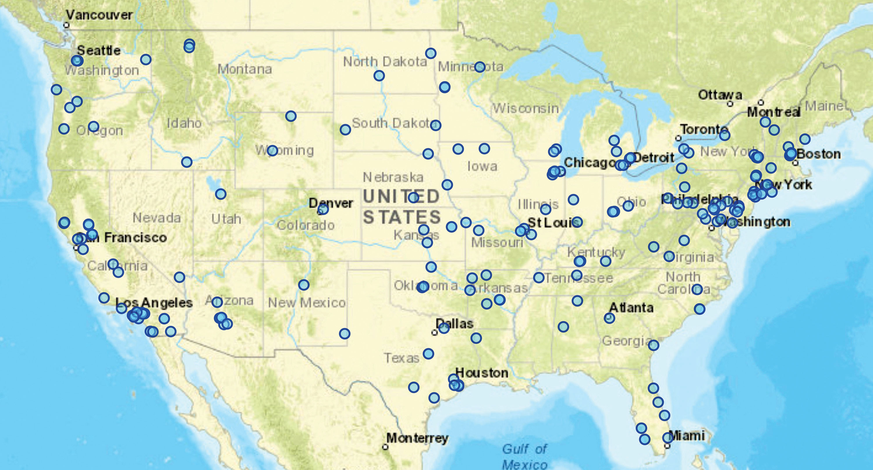
Most AMA fields in controlled airspace already have such agreements in place. There are approximately 250 such sites across the US. If you have any doubts as to whether yours is one of them, check with one of your club’s officers or the AMA.
There is one additional advantage to flying from a fixed flying site. Provided that you are following the AMA Safety Code and have an AMA Large Model Aircraft Program permit, you are allowed to operate aircraft that weigh more than 55 pounds, which is the cutoff for commercial drone operations conducted under 14 CFR Part 107.
Tell me about this LAANC thing. How do I pronounce it again?
It is pronounced "Lance," like the long, pointy weapon carried by medieval knights on horseback. LAANC was originally developed for commercial drone pilots holding a Remote Pilot in Command certificate. Before the introduction of LAANC, obtaining permission to fly in controlled airspace had to be accomplished by corresponding with the FAA headquarters in Washington, D.C., and often took three months or longer.
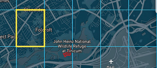
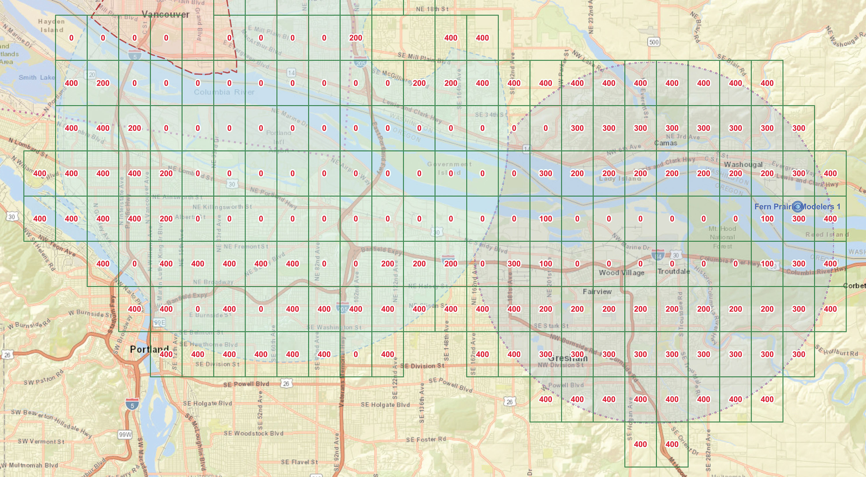
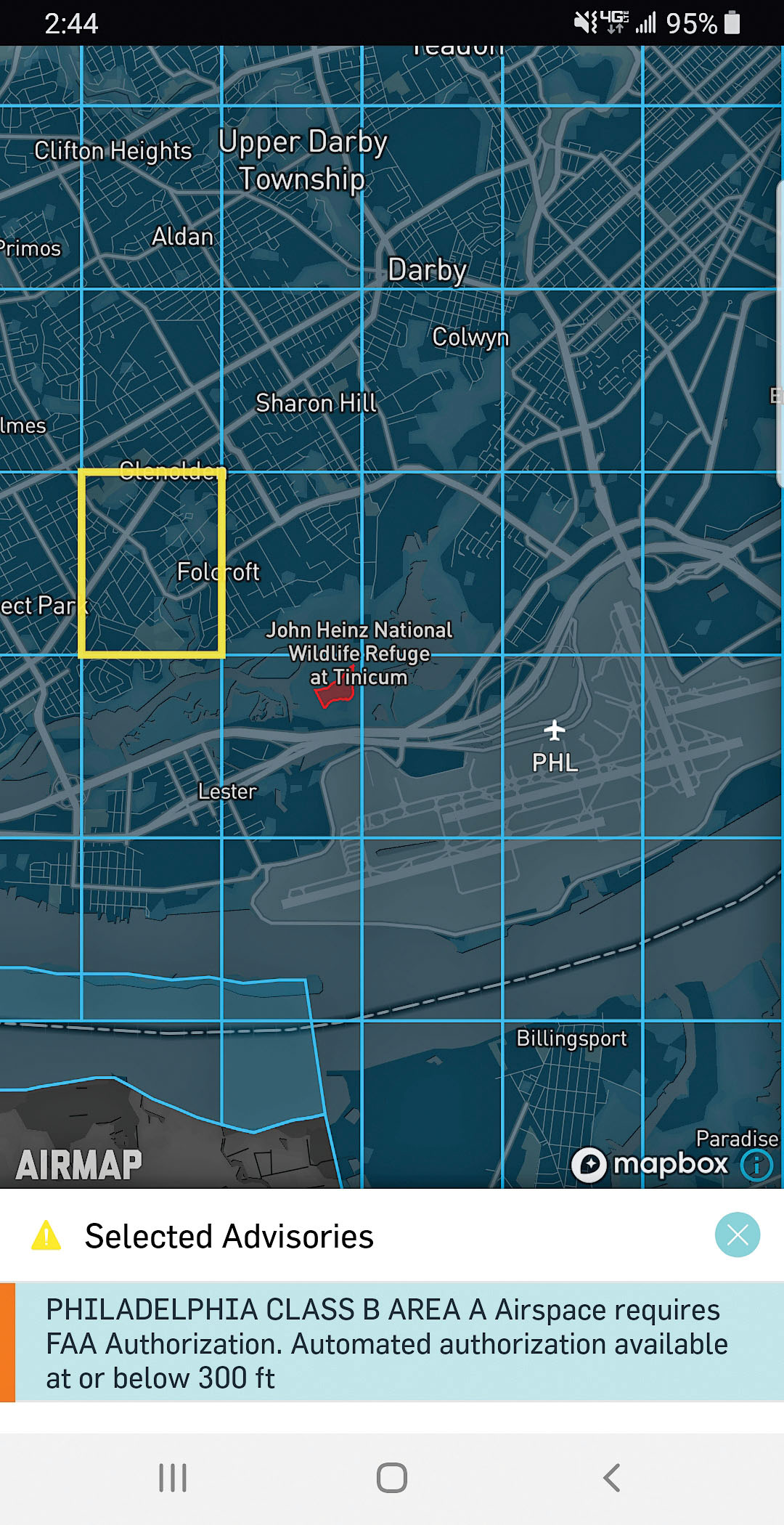
LAANC makes most of that airspace available in real time via an app on a pilot’s smartphone. The surface-controlled airspace surrounding nearly 600 airports nationwide has been divided into 1-squaremile blocks. Each block is assigned a number that corresponds with the maximum altitude that unmanned aircraft are allowed to fly.
The highest number is 400 feet—the ceiling for drone operations in most instances. As you approach the airport, the numbers decrease until they reach zero, where no flight operations are permitted without a written request to the FAA and a lengthy clearance process. Now, as a recreational pilot, you have access to exactly the same system.
Download an app that provides LAANC access onto your smartphone. Many of them, such as AirMap, which is the one I use, are available for free. Go to the location where you intend to fly and launch the app. It will use your phone’s GPS to determine your location and reveal the LAANC grid in that area. Next, simply request permission to fly under the Section 44809 rules. Within seconds, you will receive a text message with an authorization number.
How will I know if I’m in Class G airspace and do not require authorization?
The app will tell you. There won’t be a LAANC grid at your location because no authorization is required before you fly.
Alternatively, you could learn to read sectional charts, which are old-school paper maps still widely used in aviation today. They can be challenging for beginners to understand, so it helps to have an experienced teacher, but it’s a rewarding process that will help you appreciate the complexity and effectiveness of the NAS.
This is great! As long as I’m in Class G airspace, I’m good to go, right?
Not so fast. All of the regular rules still apply. As model airplane or drone pilots, we are always required to yield the right-of-way to full-scale aircraft. We also need to be aware of Temporary Flight Restrictions (TFRs) issued by the FAA. These are put in place around wildfires, major sporting events, presidential and vice-presidential visits, and other sensitive activities, and preclude all unauthorized flights.
Furthermore, many small airports are located in Class G airspace. That means, theoretically, that you could walk right up to the fence line and fly your model airplane. However, I can’t think of a worse place to go flying for fun. Occasionally, while conducting commercial operations, I fly in situations such as this, but it requires a lot of planning, coordination, and specialized equipment to do it safely.
As always, use your best judgment. Imagine that something goes wrong and you are confronted by the police, a newspaper reporter, or an FAA flight inspector. What explanation would you offer for the choices you made, and how would that reflect on you? Flying is a privilege. Treat it like one.
Let’s say I’m doing some "recreational" drone flying in my neighborhood and I happen to take a couple of pictures of my neighbor’s house. It turns out that she’s moving, so I sell her a few of my photos for her real estate agent to use. That’s okay, right?
No. In fact, it’s a pretty terrible idea. The FAA has an extremely broad definition of commercial operations. If money changes hands, that’s clearly a commercial undertaking, even if the opportunity emerges after the fact, as in this case. Even if you volunteer your services, such as searching for a missing child or helping Habitat for Humanity plan a new neighborhood, it is regarded as a commercial operation and you are required to be certified under 14 CFR Part 107.
Additionally, if you are conducting a commercial operation under the guise of hobby flying and something goes wrong, you will not be covered by your AMA insurance. Only specialized aviation liability protection will cover you.
If you want to further your skills and use them to help people, seek out training and become a licensed commercial operator. Even if you never make any money, it's rewarding to do something you love while helping others.
SOURCES:
AMA Government Relations Blog
https://amablog.modelaircraft.org/amagov
FAA
AirMap
Additional Resources:
This Month's Issue
Join the AMA
![]()


13 comments
LAANC
LAANC
Flying Site Finder
Regulation
incompetent people
Apps
Apps
The law recognizes both model airplanes and drones as aircraft,
New regs
New regulations
Gliders
New private airfield and RC club
Private airfield and RC club
Add new comment